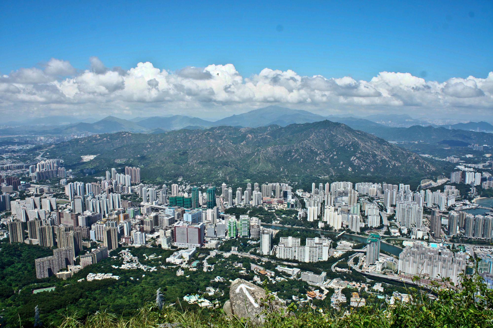
From the top of Castle Peak, hikers can sense the harmony between human and nature in Hong Kong. Hong Kongers are very conservative in reclaiming land from the nature. They respect the nature and live with the nature.
If you have a chance to view the satellite map of Hong Kong, you can see that 80% of the land consists of country park, forest and coastlines, and only 20% of the land is living space for human.
The residential area in the picture is Tuen Mun at northwest New Territories. The history of Tuen Mun can be traced back to Tang Dynasty. Its name literally means the Gate of the Troops, and it had been an important town of coastal defense.
To the east of Tuen Mun is Tai Lam Country Park, where the Maclehose Trail ends.


[…] To Shan (杯渡山) at Tuen Mun District got its name from a Buddhist monk Pui To Sim Shi (杯渡禪師) who once lived […]
Hi,
I am planning a short hike for me and my friends when we visit hong kong in the last week of june. Is castle peak easy to climb? As I will be lodging around the Tuen Mun district, I was thinking of trying castle peak. How long will the climb take? and Where do I start and end?
Please reply me ASAP.
Thanks!
Cheers,
Jolene
Hi Jolene,
Castle Peak is kinda challenging. It would take 2-3 hours to reach the peak, but the view is amazing. You can start from Tsing Shan Monaster Path and end at Kei Leung Primary School.
[…] is also far away from the city. Tourists need to take MTR to Tuen Mun Station. Take Bus K52 at Tuen Mun Town Center to get there. Since there is only one bus going there, after sunset, there might be a long queue […]
Hi. My friends and I are going to Hong Kong this June and we’re planning for a short hike as well. It will be our first time in HK and we know nothing about the place, so would it be possible for us to have a local accompany us along?
Hi my friend, you can find lots of hiking groups in HK on meetup.com. It is very easy to get around in HK because the public transportation is quite good. Most hiking trails are connected to subways and buses.